Central Volcanic Cordillera Biosphere Reserve
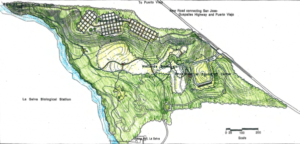
La Selva Biological Station
Environmental Education Center (La Flaminia Annex)
Puerto Viejo, Costa Rica
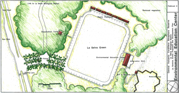
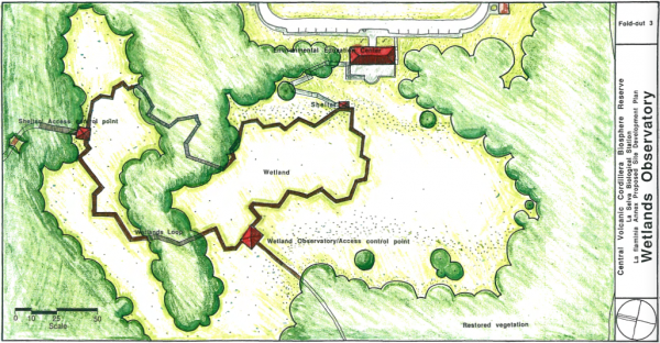
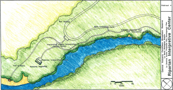
The purpose of the La Flaminia Annex is to develop educational and technical support to promote the sustainability of Atlantic Tropical Wet Forests in Costa Rica as well as to create an interface between the biological station and the community. This is accomplished through the development of a complete public access visitor center, observation tower, picnic and active play area and an interpretive wetlands loop. Water around the loop will act as a natural element to prevent unrestricted access to the rest of the site.
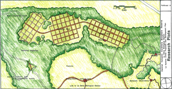
Second, visitors can chose to engage the site more fully and take a guided walk to the river, the research plots, the archeological displays and successional plots.
Third, a restricted number of guests with reservations could participate in carefully guided tours of the primary forest. Fourth, researchers and ecotourist with reservation could spend the night and utilize the extensive resources of the Central Volcanic Cordillera Biosphere Reserve, utilizing the proposed La Flaminia entrance as a gateway to the research core. These different levels of access develop a filter, which facilitate the smooth running of the research core of the reserve.
In developing the Master Plan for the La Flaminia Annex of La Selva Biological Station several design challenges were present. The first challenge was inviting people into the station while buffering daily research operations. The second challenge was to work with a design language that was understandable at all levels as well as sensitive to regional culture. Another challenge was integrating the diverse usership allowing for a wider range of user backgrounds. Lastly, developing a design which fulfilled the program needs while visually and intellectually engaging the user.
The Site
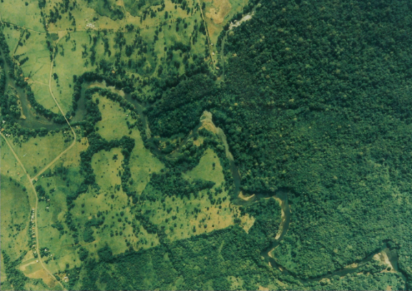
The first photograph is an aerial photograph of the region and the site. The following three photographs show specific vegetative characteristics of the site as well as the riparian zone. I performed the site surveying and baseline information gathering in the field.